Explore South Sinai: Dahab, Mount Sinai & the Gulf of Aqaba
Apply for your eVisa- Code:JS
- Type:governorate
- Native name:South Sinai Governorate
- Population:150,088 (2006)
- Area:31,272 km²
- Elevation:1,284 m
- Capital:El-Tor
Introduction
South Sinai Governorate covers the southern part of the Sinai Peninsula, a wedge of land between the Gulf of Suez and the Gulf of Aqaba that narrows to the cape of Ras Mohammed. Most of it is mountain desert: a core of granite peaks around St Catherine, among them Mount Sinai and Mount Catherine, Egypt's highest summit, falls away through wadis and sandstone canyons to coasts fringed with coral reefs. The towns stand on the shore — El Tor, the governorate's capital, on the Gulf of Suez, and Sharm El-Sheikh, Dahab, Nuweiba and Taba on the Gulf of Aqaba — with the small town of St Catherine in the mountains and Bedouin communities across the interior.
Overview
South Sinai is a holiday coast with high desert mountains behind it, and most trips take in both. Visitors usually fly into Sharm El-Sheikh for the reefs and reach the rest of the peninsula by road, on a night or day excursion or by moving on to a second base up the coast or in the mountains. The distances are short, but the roads cross empty mountain desert with little between the towns, so trips inland are usually arranged through a hotel, a dive centre or a Bedouin guide. The peninsula is a trip of its own, separate from the Nile Valley and linked to Cairo by domestic flights.
Discover South Sinai
Sharm El-Sheikh, the way in
Sharm El-Sheikh, near the southern tip, is where most visitors land and where the peninsula's big resort hotels stand; its bays and house reefs, Ras Mohammed National Park and the boat trips to the Thistlegorm belong to the resort. Eligible travellers arriving at Sharm El-Sheikh airport can take a Sinai-only permit instead of a full visa: it allows a stay of 15 days in the South Sinai resorts but not travel to Cairo or anywhere on the mainland, and the entry rules for Egypt set who qualifies. Before booking a trip inland, read your own government's current travel advice and Egypt's health and safety basics.
Dahab: the town on the Gulf of Aqaba
Dahab, about 90 minutes north of Sharm by road, is a low-rise town of guesthouses, small hotels and dive centres that grew out of a Bedouin settlement and keeps a slower pace than the resort. Its centre is a promenade along the shore, lined with restaurants and cafés where the seating is often cushions on the floor, facing the water. At the southern end of town, a shallow lagoon with a steady wind makes Dahab a base for windsurfing and kitesurfing.
Dahab's reefs and the Blue Hole
Dahab dives from the shore: the reef runs close along the coast, and dive centres drive divers and their kit by pickup to entry points such as the Lighthouse, in town, and the Canyon, to the north. The best-known site is the Blue Hole, a few kilometres north of Dahab — a sinkhole in the reef more than 100 metres deep, its rim dropping from a shallow coral edge into dark blue water. On the seaward side a shallow saddle opens the hole to the sea, and far below it an arch runs through the reef wall to the open gulf.
Nuweiba and Taba: the northern coast
Nuweiba, about an hour north of Dahab, is a quiet coastal town with the beach camps of Tarabin at its northern end; from its port a ferry crosses the gulf to Aqaba in Jordan, the sea route towards Petra. North of Nuweiba the road follows the shore to Taba, past simple beach camps of huts on the sand and the resort hotels of Taba Heights. Taba, at the head of the gulf, is the border town facing Eilat, and just offshore Pharaoh's Island carries a restored medieval fortress, reached by boat.
Mount Sinai and its two paths
Mount Sinai — Jebel Musa in Arabic — rises to 2,285 metres above St Catherine's Monastery, and tradition holds it to be the mountain where Moses received the Ten Commandments. Two paths climb from the monastery: the Camel Path, a broad track of about two and a half to three hours on which camels can be hired for most of the way up, and the Steps of Repentance, about 3,750 steps, shorter and far steeper. The two meet below the summit, and the last 750 steps to the small chapel and mosque on the top are climbed on foot by everyone. Many climbers go up the Camel Path in the dark and come down the Steps in daylight, when the views over the peaks open up.
St Catherine's Monastery
At the foot of the mountain, St Catherine's Monastery has stood inside its granite walls since the sixth century and is still home to a community of Greek Orthodox monks. Tradition places the Burning Bush here, and a bush growing within the walls is held to be it; the monastery also keeps a collection of early icons and an ancient library of manuscripts. The monastery and the mountains around it are a UNESCO World Heritage Site. Only part of the complex is open to visitors, and shoulders and knees are covered inside.
The high mountains and the Sinai Trail
Beyond Mount Sinai, the mountains around St Catherine, Mount Catherine among them, are walking country of granite peaks, high basins and walled Bedouin gardens of fruit trees in the wadis. Treks of a day or several are arranged in St Catherine and walked with a Bedouin guide, with camels carrying the gear on longer routes. The Sinai Trail, a long-distance route of about 550 km, crosses the land of several Bedouin tribes in the south of the peninsula and is walked in stages with local guides. Spring and autumn are the walking seasons: winter nights in the mountains fall below freezing, and summer days are hot even at altitude.
The Coloured Canyon and the desert camps
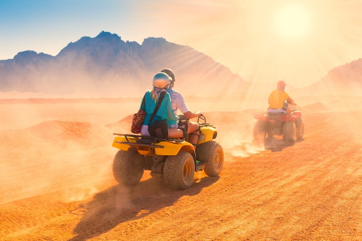
Quad bikes on a desert plain below bare mountains — one of the short desert outings run from the coast.
© erainbow / Adobe Stock
Inland from Nuweiba, the Coloured Canyon is a narrow sandstone gorge with walls banded in reds, yellows and purples; jeeps from Nuweiba and Dahab drive to its head, and the walk through it squeezes between walls close enough to touch. Shorter desert outings by camel, jeep or quad bike leave from Dahab and Nuweiba as well as Sharm, and the classic evening ends at a Bedouin camp with dinner cooked in a zarb, a pit oven in the sand, under a night sky far from the lights of the coast. Trips into the interior go with a Bedouin guide or an organised group: the tracks are unmarked and water is scarce.
Ways to Experience This Destination
Dahab's reefs reached from the beach, the Blue Hole north of town and the Gulf of Aqaba coast up to Nuweiba, with Sharm's boat sites at the southern tip.
The night climb to the summit for sunrise, and the sixth-century monastery at the foot of the mountain.
The resort bays of Sharm, the lagoon and promenade of Dahab, and simple beach camps on the shore between Nuweiba and Taba.
Guided walks in the high mountains around St Catherine, the Sinai Trail, the Coloured Canyon and evenings at desert camps.
Frequently asked questions
How do I get from Sharm El-Sheikh to Dahab and St Catherine?
Should I stay in Sharm El-Sheikh or in Dahab?
How does the night climb of Mount Sinai work?
Can I snorkel the Blue Hole, or is it only for divers?
Cities in South Sinai
Treat this Visaja page as your starting point: verify the current rules directly with the official source before you submit an application.