
Itinerary
Namibia in Two Weeks: The Booking-Window Loop
A Namibia self-drive trip looks, on the map, like a simple loop out of Windhoek — south-west to the dunes, north to the coast, further north to the desert elephants, then east to Etosha before returning to the capital. The distances are real but manageable on the country's well-maintained roads. The actual constraint on this trip isn't distance or driving skill: it's that the best in-park accommodation opens its booking window eleven months before travel dates, which means the entire shape and direction of the route has to be decided almost a year out, long before anyone's thinking about which day to drive where.
Updated 2026-09-19
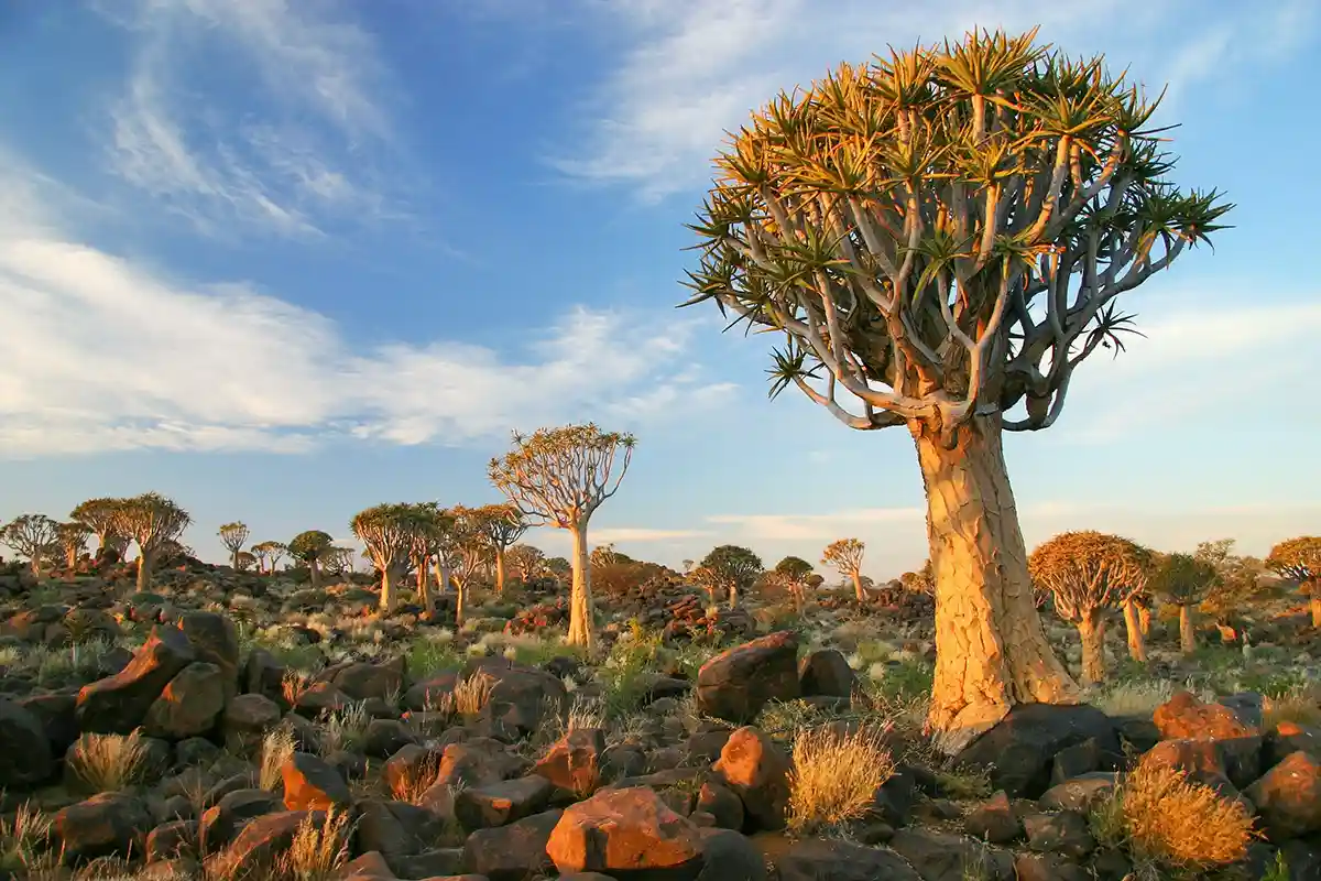
The Quiver Tree Forest near Keetmanshoop — a classic stop on the southern leg of a Namibia self-drive loop.
© Yz Wu / Adobe Stock
Before you land: the booking window that decides everything
Namibia Wildlife Resorts opens bookings for its in-park camps — Sesriem at the dunes, Okaukuejo, Halali and Namutoni inside Etosha — exactly eleven months before the travel date, and the popular dry-season dates sell out close to that opening. This is fundamentally different from booking a hotel: missing the window doesn't just mean a less convenient room, it means giving up the floodlit-waterhole camps that make a self-drive Etosha trip work the way it's meant to, or the pre-dawn access to Deadvlei that a stay outside Sesriem's gate can't match.
The practical consequence is that a Namibia trip gets planned backwards from most people's instinct: decide the travel dates and the rough loop direction first, book the in-park camps the moment the window opens, and only then fill in the private lodges and the days in between — which have far more availability and can be booked much closer to departure. A traveller who plans the days before checking the camp booking calendar routinely discovers, only months later, that the in-park nights they wanted are already gone.
Days 1-4 · Windhoek to Sossusvlei: the southern leg
Most loops start in Windhoek with a day to collect the rental vehicle, confirm the cross-border paperwork if the trip will touch Botswana, South Africa or Zambia, and adjust before the first real drive. The road south-west to Sesriem is tarred for most of its length, a comfortable introduction to Namibian distances before the roads get rougher further into the trip.
Two nights at or near Sesriem is the standard allowance for the dune country — one full day for Sossusvlei and Deadvlei with the early start that light and heat both reward, and a second morning free for Sesriem Canyon or a slower repeat visit to Deadvlei without the first day's time pressure. Travellers who added a Sossusvlei fly-over or want to drive the scenic Solitaire route toward the coast should budget a third night here.
Days 5-7 · The Atlantic coast: Swakopmund and Walvis Bay
From Sesriem, the road toward the coast runs through Solitaire and the Namib-Naukluft's changing terrain before reaching Swakopmund — a genuine shift in climate as the cold coastal fog replaces the desert heat inland. Two to three nights here covers the adventure-sport activities the town is built around, a Sandwich Harbour dune-and-ocean day trip, and a Cape Cross seal-colony excursion up the coast.
This stretch of the trip is also the practical resupply point: Swakopmund is the last place on most loops with a full range of fresh groceries and specialist gear before the roads head into thinner-infrastructure territory further north, and it's worth treating the stop that way rather than purely as sightseeing.
Days 8-11 · Damaraland and Spitzkoppe: the granite country
North from Swakopmund, the road hardens into real 4x4 country the closer it gets to Twyfelfontein, though a capable sedan can still manage the main routes with care. Three to four days here covers the Twyfelfontein rock engravings, a guided drive in search of the desert-adapted elephants along the Huab or Ugab riverbeds, and at least one night at the Spitzkoppe community campsite for the sunset and sunrise light on the granite.
This is also where the trip's pace naturally slows — fuel stations space out further apart here than anywhere else on the core loop, and building in slack rather than a tight day-by-day schedule matters more in Damaraland than it did on the tarred southern legs.
Days 12-14 · Etosha and the return to Windhoek
The final push east to Etosha rewards the eleven-month booking discipline directly: three nights minimum, ideally split between at least two of the park's camps, is what turns the waterhole circuit from a single rushed pass into the layered experience it's designed to be. Entering through the park's western side and exiting east (or the reverse, on a counter-clockwise loop) avoids doubling back across ground already covered.
From Etosha's eastern gate, the drive back to Windhoek closes the loop in a single tarred day, leaving a final night in the capital for a flight home the next morning rather than rushing straight from gravel road to airport.
Extending the loop: Kaokoland and the deep south
The core two-week loop deliberately leaves out two regions that reward a longer trip rather than a detour squeezed into it. Kaokoland and Epupa Falls, reached from a spur off Damaraland through Opuwo, add three to five days of remote 4x4 travel and are better suited to a three-week trip or a dedicated return visit than to a compressed add-on. The Fish River Canyon and the Quiver Tree Forest, in the deep south, sit far enough off this loop's natural line that they usually work best as their own separate southern trip, paired with a border crossing into South Africa, rather than as a leg bolted onto the Windhoek-Etosha-coast circuit.
Compressing to ten days: cut a night from Damaraland before cutting nights from Etosha or Sossusvlei — the waterhole circuit and the dunes are harder to shortchange than the granite country's more flexible pace. Extending to three weeks: Kaokoland is the natural addition, not the deep south, since it connects directly onto the existing Damaraland leg rather than requiring a separate journey.